


Rafael Fire Morning Update – June 25, 2021
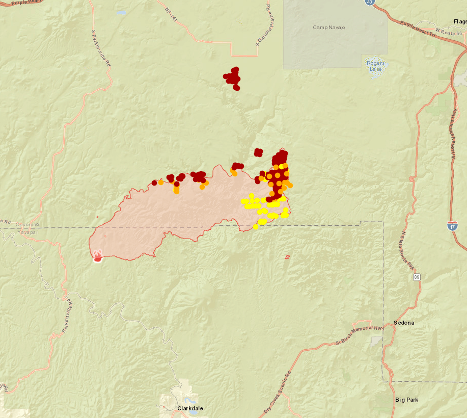
Acres: 39,641
Percent Containment: 0%
Date/Time Detected: Friday, 06/18/2021 at 1927 MST
Structures Damaged/Destroyed: 0
Number of Personnel: 311
Cause: Lightning
Origin/Location: 4 miles north of Perkinsville

Fire crews continued burning operations until early evening along road systems north, east and west of Sycamore Canyon. Crews will continue prepping fire lines by reducing fuels through thinning and removal in and around White Horse Lake on the Kaibab NF and along Forest Roads on the Coconino NF.
As the firing operations continue, expect to see more smoke the next few days. Firefighters will scout for fire line locations on the northwest end of the fire today near Government Canyon and Wagner Hill. On the east end crews will scout for and prepare containment lines for firing operations in Red Rock Secret Mountain Wilderness, and structure protection specialists will identify values at risk in Sedona area. On the south side near Mooney Canyon, firefighters will monitor the retardant line from yesterday’s burn out operation. For information on evacuation status, and fire activity, there will be a virtual community meeting every day at 6 p.m. until further notice, on the Incident Facebook page: https://www.facebook.com/RafaelFireInfo/

Evacuation status as of 6 a.m. June 25 (Notifications are in place until status is rescinded or changed by each respective County Sheriff’s Office):
“GO” in Coconino County, areas around Sycamore Canyon and South of Forest Service Road 535 off FS 231 (Sycamore Canyon) and Garland Prairie South. In Yavapai County, some rural ranches in the area of North FSR 525 and Bill Grey Road, West of Sedona (Loy Ranch). A shelter for evacuees is set up at Sinagua Middle School at 3950 E. Butler in Flagstaff.
“SET” – in Coconino County, areas around Camp Navajo, Garland Prairie North, Pine Aire Estates and residents in between. In Yavapai County, Bill Grey Road (Grey Ranch), FS Road 525 (Windmill Ranch), and FS Road 152C and Bear Mountain Road (Bear Mountain).
“READY” -– in Coconino County, all areas south of I-40, west of I-17 including the following neighborhoods: Westwood Estates, Flagstaff Ranch (including W.L. Gore), Pine Del, Forest Highlands, Kachina Village, University Heights, Mountain del, and Equestrian Estates and in Yavapai County, the areas north of AZ-89A in West Sedona have been placed on “Ready” status.

Notifications can change rapidly. Residents in areas affected by the fire should remain vigilant and be prepared to evacuate. Evacuation notifications are issued when danger is imminent and life threatening.
Information about evacuation status can be found on the Coconino County Emergency Management’s Facebook page at: https://www.facebook.com/coconinoEM/ and at the Yavapai County Sheriff’s Department Facebook page at: https://www.facebook.com/YavapaiCountySheriff/
All State Land is under Stage 2 restrictions effective 8 a.m. on June 11. All Arizona State Trust lands will be closed effective Friday, June 25 at 8 a.m.
A Beechcraft King Air 90 twin-turboprop is making reconnaissance flights above the Rafael Fire in preparation for fire suppression air attack efforts on Friday, June 25.


