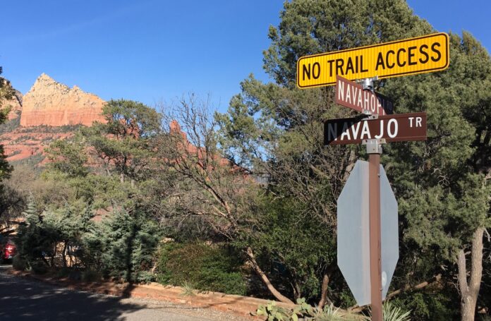
If you’re in Uptown and turn onto Navahopi Road from Jordan Road, you’ll likely notice a bright yellow sign above the stop sign on the corner that reads “No trail access.”
Keep going up the hill, and you’ll come to an identical sign at the corner of Navahopi and Navaho Trail — or Apache Trail, as the road forks immediately. The signs are very clear. There is no trail access.
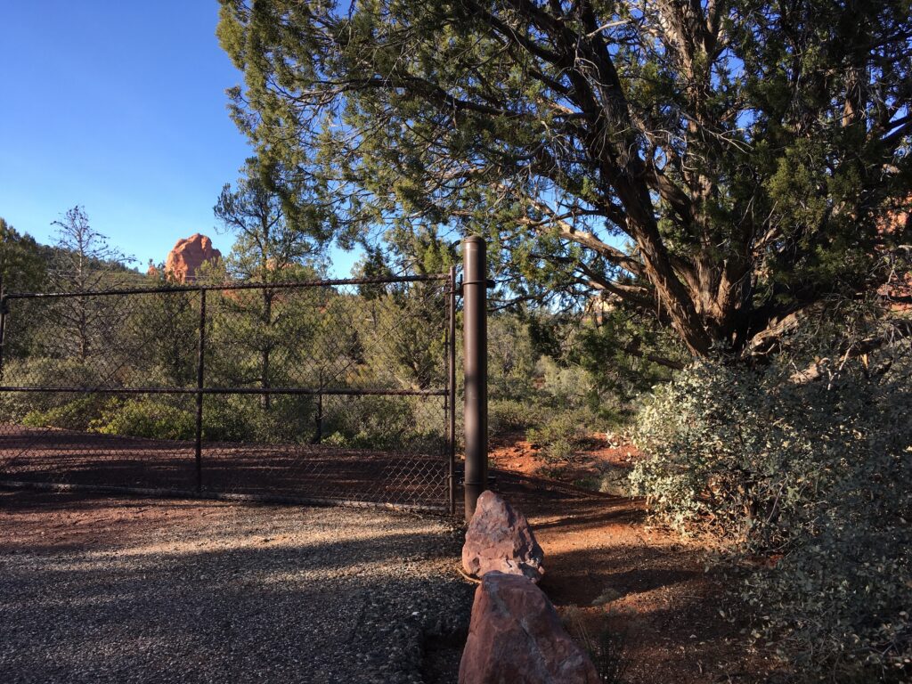
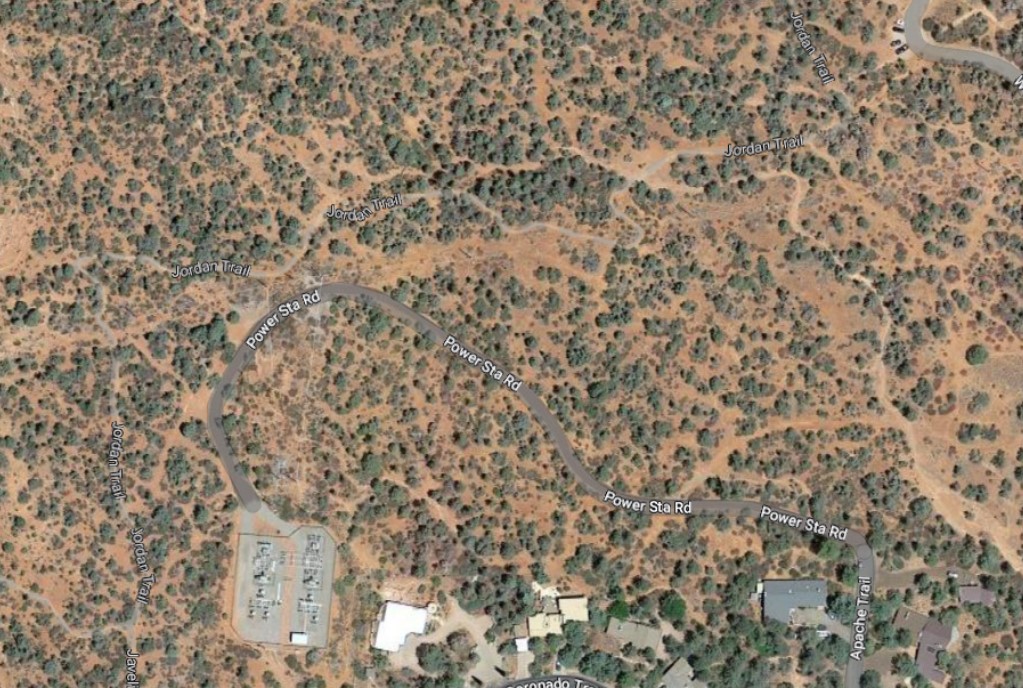
On the other hand, if you make a right turn onto Apache Trail and follow it to the end of the street, you’ll come to a vehicle gate at the Coconino National Forest boundary line. Next to the vehicle gate, and ungated, is an obvious pedestrian access point. Hikers who step past the gate can choose to follow Power Station Road uphill until they are a couple dozen steps from the Jordan Trail, or they can head down the hill off to their right into a dry wash, which will also lead them, by a more scenic route, to the Jordan Trail.
While there is no parking available at this unmarked, unofficial trailhead, it is an easy walk from the city’s Uptown parking lots. Reaching this access point on foot from Uptown also takes less time than reaching the Jordan Road Trailhead by following Jordan Road and West Park Ridge Drive.
Street signs in Sedona are the responsibility of the city’s maintenance service division within the department of public works. According to city Public Works Director and Assistant City Manager Andy Dickey, these “No trail access” signs were installed in 2021.
“[These] signs were installed at the request of residents who live in the neighborhood, due to vehicles parking and impeding the roads at both locations,” Dickey said. “There have been similar requests on roads with names followed by [the] suffix ‘trail.’ Visitors see the suffix ‘trail,’ and may assume a forest trail connection. We have denied requests to place ‘No trail access’ signs where official trail access does exist.”

“Official trail access” appears to be the key term with regard to the city’s decisions on sign placement.
“Our staff researched access at the time the signs were installed,” Dickey stated. “At the time we found there is access to the APS power station via locked gate, but no official trail access was found at the time this was researched. This does not appear to have changed.”
Physical access to Jordan Trail from Navahopi via Apache Trail exists even if the signs say otherwise, making the signage misleading.
While the city does not maintain a list of locations where “No trail access” signs have been installed, Dickey admitted that the city has installed them in other areas, including at the intersection of Cathedral Rock Trail and State Route 179 and at the intersection of Painted Cliffs Drive and Soldier Pass Road. He added that the city declined a request for such a sign on Cline Road.
Another unmarked trail access point, which the city has not yet signed as having no trail access, connects the traffic circle at the end of Manzanita Spur to the Javelina Trail. This connection is even closer to most of Uptown than the Jordan Trail access point off Apache.


