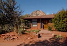
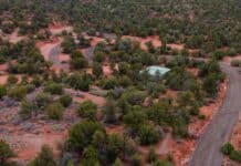
Sedona is riddled with hundreds of miles of trails, coursing through and around the city like veins through the human body.
Trails are a part of the Sedona experience for locals, snowbirds, mountain bikers, tourists, spiritual getaway-goers and more. They all use trails for different reasons, but the common denominator is the beauty through which they transport visitors, and the vitality of trails is obvious.
One of the more popular trails around is Broken Arrow Trail, which ends at Chicken Point. It is 1.7 miles in each direction, but without much change in elevation, it does not feel like it.
“It’s short with a big payoff at the end,” said Megan Costello of Phoenix. “It’s interesting enough without being too difficult. I chose it because it was easy and not too difficult for my son [Boden, 10 years old].”
The trail, which travels south, is a mix of clearly marked dirt paths and a bit of mostly flat, slick rock. Cairns clearly mark the entire route, which intersects with a few other trails, allowing hikers to mix up their routes over multiple visits.
A few minutes down the trail is a fenced off area. Beyond the fence is the Devil’s Dining Room Sinkhole, which bats call home, with signs that educate passersby. Farther down the trail, hikers can climb up toward Twin Buttes.
According to a sign at the trailhead in the parking lot, the trail offers views of Battlement Mesa along with the sinkhole and Twin Buttes.
Lined with trees and multiple species of cactuses, the trail eventually crosses paths with Submarine Rock Trail, a 0.7-mile extension that travels up slick rock to the east. As hikers draw closer to Chicken Point, they will come upon one of the area’s three H trails: High on the Hog.
For mountain bikers, High on the Hog is one of Sedona’s double black diamond trails. Mountain biking is not extremely popular on Broken Arrow because of some steep, rocky climbs and descents.
However, once at Chicken Point, a white line is clearly visible cutting across the rock face high on the right — a popular place for bikers. It is much flatter than its nearly impossible and life-threatening appearance it gives off from below.
Erik Wohlert, who was in Arizona for business, came to Sedona specifically to get as many miles in as possible on a mountain bike. Wohlert said it was probably his sixth time riding in the area.
“I think the views are pretty awesome along the way,” he said. “Once you get to Chicken Point it’s certainly a pretty view. It’s got the white line trail.”
The final option is to get on to Margs Draw Trail, which offers its own myriad options. Margs Draw is 1.9 miles in one direction, and connects to Margs Draw Spur and Huckaby Trail in addition to Schnebly Hill Road.
Following Margs Draw puts hikers in Munds Mountain Wilderness, according to the parking lot sign, and eventually with views of more landscape that include Camel Head and Snoopy Rock.
Soon before reaching Broken Arrow Trail’s end there is another noteworthy rock formation: Twin Nuns. Jeep tour companies bring groups to Chicken Point via the 4-wheel drive trail that runs close to the hiking trail. The sounds of their engines are practically the only sign of civilization. From Chicken Point there is a slight view of Sedona looking back toward the north. To the south is a view of Bell Rock and miles of open land.
“It’s a mental Kodak,” said Angie Braford of St. Louis, Mo. “It makes you feel like a speck of time, it’s so old. It’s like the history and science stuff. You’re actually in it.”
At Chicken Point they’re is another rock that is iconic with tourists for its photo opportunity. One can lie down on it and pretend to be hanging on for dear life. As long as the photographer leans over for the right shot, it can look as though one is about to fall off the edge of a cliff.
The trail is mostly exposed to the sun, and of course hikers should wear proper footwear and bring plenty of water.
Broken Arrow Trail is just one of many scattered throughout Sedona and the surrounding land. It can be one of the best for finding beautiful views without devoting too much time under the punishing Arizona sun.
Getting There
From Sedona, drive south on State Route 179 toward the Village of Oak Creek. Take the third exit off the roundabout marked for Morgan Road. At the end of Morgan Road is a one-car dirt road. Follow that road for a short distance before coming upon the parking lot, which is on the left.
Continuing straight on that road leads to the 4-wheel drive trail; only properly-equipped off-road vehicles should drive on it.
The trailhead is toward the entrance of the parking lot on the south side.
Parking is free of charge, but fills quickly on the weekends. Pets are welcome, but must be on a leash. No smoking is allowed due to fire restrictions.


