


The Coconino National Forest is managing two lightning-caused wildfires both of which are causing smoke issues in Sedona and the Verde Valley. There are no structures threatened by the fires.
Scott Fire
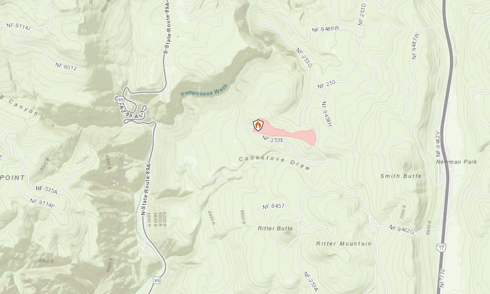
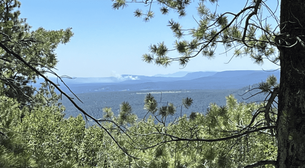
The Scott Fire, located roughly 9.66 miles north-northeast of Sedona city limits is burning 1.2 miles due east of the State Route 89A switchbacks between I-17 and State Route 89A (GPS: 35°01’29.4″N 111°43’04.3″W). The fire was first reported 5 p.m. Monday, July 31. Fire personnel on the Scott Fire include one Hotshot crew, one hand crew, two engines, one dozer and miscellaneous overhead vehicles. The fire is currently 80 acres in size and is burning in ponderosa pine, Gambel oak and pinyon-juniper roughly 5 miles south of Kachina Village between Interstate 17 and US Highway 89A.
Northern Arizona Type 3 team assumed command of the fire Saturday Aug. 5 at 6 a.m. Hand line and dozer line construction and prepping along roads by reducing fuels is occurring on the northern half of the fire. Closure order for public safety implemented on the fire Saturday. Weather is expected to be hot and dry with increasing wind through the weekend. Moisture gradually returns next week.
- Planned Actions: Continue line construction and prepping lines for potential burning operations and burning operations on the north edge of the fire along containment lines.
- Projected Incident Activity:Continue line construction and prepping lines for potential burning operations that may occur on the northeast corner of the fire.
Luke Fire
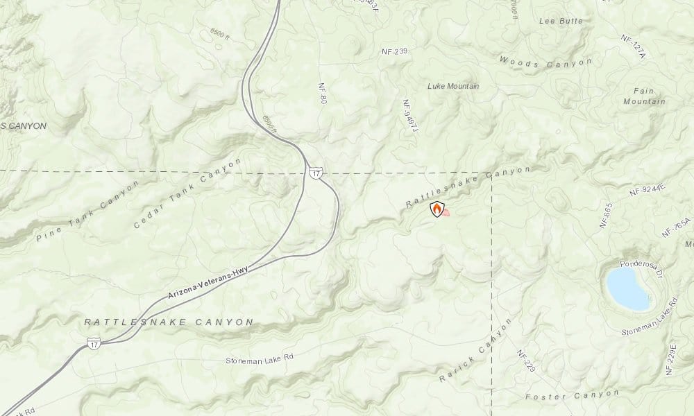
The Luke Fire is 8.5 acres and is located east of I-17 toward the direction of Stoneman Lake (GPS: 34°47’42.8″N 111°33’55.9″W). It was first reported 4 p.m. Monday, July 31 and is experiencing minimal fire behavior. Resources assigned to the Luke Fire include three engines and miscellaneous overhead vehicles.
The Coconino National Forest is managing the Luke Fire.
Grapevine Fire & Racetrack Fire
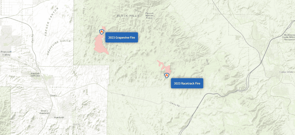
The Prescott National Forest took command of the 10,49-acre Grapevine fire at 7 a.m., Friday Aug. 4, from the Central West Zone Type 3 Incident Management Team, which had provided command for the resources deployed from all around the state for 13 days while coordinating with Yavapai County, municipal and various other agencies including volunteers. The CWZT3 met objectives the PNF outlined to provide safety to fire personnel and the public while suppressing the Grapevine Fire.
The fire is 51% contained. The fire behavior has been minimal with few fuels in the fire area available to burn. Recent precipitation has caused live fuel moistures to increase, while dead fuel moistures will steadily decline due to forecasted hot and dry weather. Minimal fire behavior is expected. The PNF will continue protecting property and conducting assessments to make repairs to signs, fences, roads and any areas damaged by fire suppression efforts.
The 405-acre Racetrack fire, which began July 23, was fully contained Sunday, July 30. Although there is no threat of fire spread or potential growth; firefighters will continue to patrol and monitor containment lines by ground and air. Light smoke may be visible at times as isolated interior fuels continue to burn and smolder.
USFS statement on wildfires
Wildfires are a natural part of the Coconino NF’s ecosystem, and when managed diligently and properly following the requisite planning process, improve the landscape long-term in several ways.
Low-intensity fire works to release nutrients into soils and reduce the accumulation of hazardous fuels on the forest floor, such as dry pine needles and fallen leaves.
The management of naturally-ignited wildfire can also protect critical infrastructure, watersheds, wildlife habitat and culturally sensitive areas from future high-severity wildfires.
The Scott and Luke wildfires are in areas where previous fires have occurred and prescribed fires are planned. Managing both the Scott and the Luke wildfires for forest health will increase the amount of treated land near Kachina Village and Mountainaire and work to tie together the fire history in this fire-dependent ecosystem.
This will help further reduce hazardous fuels and help protect infrastructure, property and resources near the surrounding communities.
The management of these fires aligns with the Forest Service’s 10-year Wildfire Crisis Strategy, which aims to increase the use of fire on the landscape as well as other treatments to improve forest resiliency for generations to come.
There are no active road, trail or area closures at this point, but forest visitors are asked to avoid the fire areas and remain cognizant of firefighting operations.


